Category:Maps needing South Sudan political boundaries
This category is for maps that need the addition or editing of the borders of South Sudan. Maps depicting events or data from before 9 July 2011 (South Sudan's independence day) do not need South Sudan's borders unless it is implied that the map needs to use "current" borders.
Subcategories
This category has the following 10 subcategories, out of 10 total.
Media in category "Maps needing South Sudan political boundaries"
The following 200 files are in this category, out of 398 total.
(previous page) (next page)-
800px-tropical wet forests.png 10,000 × 4,972; 1.85 MB
-
ABB world map.svg 840 × 426; 1.38 MB
-
Acacia-catechu-range-map.png 800 × 352; 99 KB
-
Acacia-catechu-range-map2.png 800 × 352; 96 KB
-
Acacia-caven-range-map.png 800 × 370; 80 KB
-
Acacia-karoo-range-map.png 800 × 352; 71 KB
-
Africa (political) 22.18772E 0.25705N.jpg 1,280 × 958; 107 KB
-
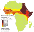
Africa sand dams.jpg 388 × 422; 64 KB
-
Africa wolves.jpg 1,152 × 804; 154 KB
-
Africa.NileMap.01.png 200 × 252; 72 KB
-
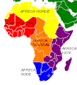
Africapartes.gif 313 × 346; 6 KB
-
Afrika Kolonisation Farben.png 982 × 991; 216 KB
-
Afrika Politisch 2.png 982 × 991; 210 KB
-
Afrikamapde.png 1,050 × 1,152; 46 KB
-
Afrikatop50metropoles.jpg 1,792 × 2,048; 602 KB
-
Afrique habitat du potagomale.PNG 644 × 600; 111 KB
-
Afrotropique.png 1,096 × 744; 54 KB
-
Afrotropiquelogo.png 242 × 410; 11 KB
-
Ahu projects africa.jpg 543 × 525; 83 KB
-
Allianz global locations.svg 940 × 415; 1.51 MB
-
Amdang map.png 331 × 530; 11 KB
-
Andrias japonicus distribution.PNG 508 × 397; 15 KB
-
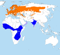
Anthus trivialis distr.png 2,428 × 2,218; 298 KB
-
APEC Member Nations.JPG 2,645 × 1,199; 205 KB
-
APEC Memberstates.PNG 2,645 × 1,199; 128 KB
-
Aquila clanga area frei png.PNG 2,966 × 2,233; 1.76 MB
-
Aquila heliaca area frei.jpg 2,487 × 1,441; 385 KB
-
Aquila heliaca area.png 2,395 × 1,392; 118 KB
-
Arabischtalige landen.png 659 × 388; 66 KB
-
Arabscina v svetu.png 659 × 388; 86 KB
-
Arapski u svijetu.png 659 × 388; 88 KB
-
Arvicola amphibius range map.png 921 × 470; 75 KB
-
Asian Development Bank (DMC Stages).png 1,357 × 628; 48 KB
-
Asian Development Bank.png 1,357 × 628; 47 KB
-
AsianDevelopmentBankMap.png 1,357 × 617; 47 KB
-
AT0713 map.png 1,369 × 561; 41 KB
-
AT0715 map.png 667 × 830; 27 KB
-
AT0904 map.png 932 × 844; 30 KB
-
AT1007 map.png 847 × 844; 37 KB
-
AT1303 map.png 1,057 × 835; 29 KB
-
AT1305 map.png 897 × 844; 28 KB
-
Australasia.png 1,096 × 744; 47 KB
-
Australasien.png 1,096 × 744; 54 KB
-
Außengebiete der Vereinigten Staaten.png 2,200 × 1,121; 366 KB
-
Azerbaijan (orthographic projection).svg 551 × 551; 570 KB
-
Baumaxbm.jpg 1,800 × 820; 115 KB
-
Berbers.png 592 × 465; 62 KB
-
Berta languages.png 282 × 299; 4 KB
-
Bilderberg Attendees.png 1,800 × 820; 119 KB
-
Bioko Forest Shrew area.png 297 × 333; 7 KB
-
BK Asia (orthographic projection).png 541 × 541; 110 KB
-
BK world map 1.png 2,379 × 1,083; 242 KB
-
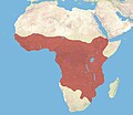
Brown Hyaena area.png 297 × 333; 9 KB
-
Burger king world locations 2.png 1,357 × 628; 29 KB
-
Burger king world locations.PNG 1,357 × 628; 54 KB
-
Burger king world locations.png 1,504 × 707; 56 KB
-
Burger King world map.png 2,047 × 932; 381 KB
-
BurgerKing Asia (orthographic projection).png 541 × 541; 103 KB
-
Calidris temminckii distribution map.png 4,071 × 3,019; 250 KB
-
Canada Turkey Locator.svg 940 × 415; 1.7 MB
-
Carte Coffea robusta arabic-ar.png 4,500 × 2,223; 1.06 MB
-
Carte peuples turcs.png 1,690 × 1,036; 99 KB
-
Celtel-map.png 757 × 785; 27 KB
-
Celtel-one-map.png 757 × 785; 28 KB
-
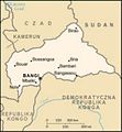
Central African Republic CIA map PL.jpg 338 × 364; 43 KB
-
Central African Republic Topography.png 1,928 × 1,311; 3.97 MB
-
Central Sudanic Languages.png 879 × 560; 17 KB
-
Certhia familiaris Certhia hodgsoni.png 1,300 × 700; 69 KB
-
Chacma Baboon area.png 297 × 333; 10 KB
-
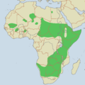
Cheetah range.png 929 × 932; 40 KB
-
Ciconia nigra distr.png 1,920 × 1,330; 674 KB
-
Circaetus gallicus distr.png 2,048 × 1,191; 337 KB
-
Circumcision Prevalence using a gray scale.svg 863 × 443; 1.69 MB
-
Circus cyaneus breeding area.png 2,279 × 1,414; 223 KB
-
Circus ranivorus distribution.png 1,432 × 1,424; 102 KB
-
Cloud forest Bosque Nuboso world distribution.jpg 1,253 × 603; 114 KB
-
Cloud rainforest world distribution.jpg 1,253 × 603; 63 KB
-
CNN News bureaus world.png 1,393 × 628; 40 KB
-
CNN News bureaus world.PNG 1,393 × 628; 40 KB
-
Cocos nucifera origin native range map.svg 512 × 251; 934 KB
-
Colonies in Africa in 1914.jpg 2,203 × 2,080; 515 KB
-
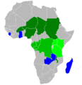
Community of Sahel-Saharan States.png 585 × 600; 53 KB
-
Coracias garrulus distr new03.png 1,108 × 1,182; 541 KB
-
Countries where over 50% of the population are native English speakers.png 1,800 × 820; 104 KB
-
Crex crex distr.png 2,700 × 1,980; 292 KB
-
Criminalization of marital rape map.svg 940 × 477; 1.61 MB
-
Cypron-Range Caretta caretta.svg 660 × 340; 2.05 MB
-
Cypron-Range Vulpes lagopus.svg 660 × 340; 2.33 MB
-
DABcountries.png 1,162 × 630; 119 KB
-
Dancing With the Stars Map.svg 940 × 415; 1.22 MB
-
Dancing with the stars world map.PNG 1,357 × 628; 26 KB
-
Dancing With the stars world map2.png 1,357 × 628; 28 KB
-
Dancing With the stars world map3.png 1,357 × 628; 18 KB
-
Deutsche Telekom world locations.svg 840 × 370; 1.37 MB
-
DeutschsprachigeWelt.png 2,644 × 1,196; 92 KB
-
Difusionpoicephalus.jpg 585 × 648; 34 KB
-
Difusionsenegal.jpg 566 × 613; 126 KB
-
Distribution M. tricuspis.png 757 × 785; 122 KB
-
Distribution Macheiramphus alcinus subspecies.PNG 2,736 × 1,496; 156 KB
-
Distribution Macheiramphus alcinus.PNG 2,736 × 1,496; 156 KB
-
Distribution of haplogroups C (Y-DNA).png 1,200 × 739; 787 KB
-
Distribution of haplogroups D (Y-DNA).png 1,200 × 739; 779 KB
-
Distribution of haplogroups F (Y-DNA).png 1,200 × 739; 775 KB
-
Distribution.caudata.1.png 1,357 × 628; 30 KB
-
Duterte foreign trips.png 1,800 × 820; 181 KB
-
DVD-Regions with key.png 1,350 × 625; 16 KB
-
DVD-Regions without key.png 1,350 × 625; 15 KB
-
Eastern Afromontane map.png 672 × 716; 101 KB
-
Eastern Gorilla area.png 473 × 364; 17 KB
-
Eastern Hemisphere LamAz.png 800 × 800; 21 KB
-
Eastern Sudanic Languages.png 449 × 454; 9 KB
-
ECCAS.png 323 × 360; 12 KB
-
AT0705 map.png 1,336 × 844; 54 KB
-
Ecozones.jpg 1,096 × 744; 104 KB
-
Empire of the Great Qing (orthographic projection).svg 600 × 600; 457 KB
-
Ethiopia Afar locator.png 740 × 600; 129 KB
-
Ethiopia Topography.png 1,116 × 1,046; 1.68 MB
-
Ethiopia-admin-ru.png 1,486 × 1,149; 38 KB
-
Ethiopia-CIA WFB Map sl.jpg 330 × 355; 24 KB
-
Ethiopia-map-blank.png 330 × 355; 7 KB
-
Etihopiekaart.png 440 × 473; 50 KB
-
EU location.png 1,427 × 628; 2.57 MB
-
Eurasian Lynx area.png 712 × 532; 34 KB
-
Euro-Währungen in Afrika.PNG 495 × 467; 15 KB
-
Eurocephalus (Genus) distr02.png 703 × 806; 426 KB
-
Exclusive Economic Zones by boundary type.png 8,015 × 4,372; 3.57 MB
-
Fagaceae Distribution.svg 940 × 477; 1.73 MB
-
Falco concolor distr.png 1,137 × 1,099; 62 KB
-
Falco eleonorae distr.png 940 × 1,180; 57 KB
-
Falco eleonorae distr02.png 940 × 1,180; 58 KB
-
Falco eleonorae new distr.png 940 × 1,180; 57 KB
-
Falco naumanni distribution.png 1,100 × 761; 303 KB
-
Falco peregrinus map.jpg 1,357 × 628; 235 KB
-
Felidae range.png 1,480 × 625; 61 KB
-
Fgm map eu.svg 640 × 612; 107 KB
-
Fgm map-es.svg 640 × 612; 71 KB
-
Fgm map.jpg 320 × 306; 34 KB
-
Florenreiche.jpg 1,096 × 744; 164 KB
-
FON WIFI world locations.svg 840 × 371; 914 KB
-
Frankofonia.png 659 × 388; 89 KB
-
Fur languages.png 552 × 231; 6 KB
-
Gay military.svg 636 × 336; 1.8 MB
-
Genus Otus ~ Regions of greatest splitting.png 1,624 × 1,120; 217 KB
-
Geographic distribution of mtDNA haplogroups of African and European.png 3,897 × 2,810; 185 KB
-
Geographic distribution of Y chromosome haplogroups of African and European.png 3,999 × 2,781; 248 KB
-
Geographical frequency distribution of Haplogroup J1-M267 (Y-DNA).png 2,410 × 1,836; 1.71 MB
-
Geographical frequency distribution of Haplogroup J2a-M410 (Y-DNA).png 2,443 × 1,588; 1.76 MB
-
Geographical frequency distribution of Haplogroup J2b-M102 (Y-DNA).png 2,447 × 1,523; 1.54 MB
-
Geographical frequency distribution of Haplogroup J2b1-M205 (Y-DNA).png 2,396 × 1,441; 1.39 MB
-
Geographical frequency distribution of Haplogroup J2b2-M241 (Y-DNA).png 2,399 × 1,433; 1.38 MB
-
Gerenuk Litocranius walleri distribution map.png 770 × 800; 90 KB
-
Giraffa camelopardalis distribution-ar.png 495 × 429; 57 KB
-
Giraffa camelopardalis subspecies map new.png 970 × 900; 520 KB
-
Giraffa camelopardalis subspecies map.jpg 970 × 900; 115 KB
-
Giraffa camelopardalis subspecies map.png 970 × 900; 595 KB
-
Global Burger King locations.png 1,357 × 628; 18 KB
-
Global frequency distribution map of haplogroup Q-M242 (Y-DNA).png 1,578 × 934; 1.17 MB
-
Global Map of Male Circumcision Prevalence at Country.svg 863 × 443; 1.7 MB
-
Global Map of Male Circumcision Prevalence by Country.svg 856 × 434; 1.93 MB
-
Golden ratios on map of the world.png 800 × 352; 102 KB
-
Gorilla distribution4.png 644 × 600; 125 KB
-
Gorilla distribution5.png 284 × 189; 29 KB
-
Gray wolf subspecies original.gif 800 × 588; 24 KB
-
Gray wolf subspecies original.PNG 799 × 589; 49 KB
-
Greater israel map.png 2,040 × 1,232; 117 KB
-
Gulo gulo distribution.svg 2,048 × 1,025; 905 KB
-
H&M World map.svg 840 × 426; 1.38 MB
-
Haagen-Dazs world map.svg 840 × 426; 1.34 MB
-
Habitat range of the African civet.jpg 7,664 × 6,672; 10.85 MB
-
Haematopus ostralegus distr.png 725 × 398; 121 KB
-
Haliaetus albicilla distr.png 2,868 × 1,367; 310 KB
-
Hennes & Mauritz.svg 940 × 477; 1.62 MB
-
Hieraaetus spilogaster distr.png 1,028 × 1,065; 99 KB
-
Highveld Golden Mole area.png 297 × 333; 8 KB
-
Hippopotamuses Map Range Hebrew.png 1,251 × 1,341; 329 KB
-
Hui-chiu sit-bin-te 1914.png 900 × 817; 164 KB
-
Human Y-chromosomal phylogeny and haplogroup distribution.png 1,890 × 2,143; 956 KB
-
Hyaena hyaena map.png 497 × 386; 18 KB
-
Igad2.png 997 × 996; 237 KB
-
Image-Masairange.jpg 646 × 599; 43 KB
-
Indian Gray Mongoose area.png 509 × 261; 14 KB
-
Indian Hare area.png 712 × 532; 26 KB
-
Indomalais.png 1,096 × 744; 54 KB
-
Indomalaya.png 1,096 × 744; 48 KB
-
Internationalwaters.png 2,410 × 1,178; 186 KB
-
Internet Penetration.png 3,600 × 1,640; 553 KB
-
Iraq (orthographic projection).svg 680 × 680; 319 KB
-
Israel People's Republic of China Locator.png 989 × 656; 44 KB
-
Israel South Africa Locator.svg 940 × 415; 1.47 MB
-
Israel-india locator.png 749 × 656; 38 KB
-
Jebel languages.png 300 × 367; 11 KB
-
Jynx torquilla distr.png 1,712 × 926; 241 KB
-
Kaufl.jpg 1,800 × 820; 114 KB
-
Kenya CIA map PL.png 330 × 353; 10 KB
-
Kingdom of Kara-Khanids- 999-1212.png 752 × 590; 36 KB
-
Kipunji area.png 297 × 333; 7 KB
-
Kolonisation Afrikas.png 900 × 817; 214 KB
-
Komuz languages.png 352 × 351; 5 KB


_22.18772E_0.25705N.jpg/120px-Africa_(political)_22.18772E_0.25705N.jpg)






.png/120px-Asian_Development_Bank_(DMC_Stages).png)




.svg/120px-Azerbaijan_(orthographic_projection).svg.png)




.png/120px-BK_Asia_(orthographic_projection).png)


.png/120px-BurgerKing_Asia_(orthographic_projection).png)








.png/120px-Distribution_of_haplogroups_C_(Y-DNA).png)
.png/120px-Distribution_of_haplogroups_D_(Y-DNA).png)
.png/120px-Distribution_of_haplogroups_F_(Y-DNA).png)


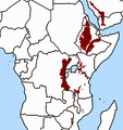

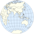


.svg/120px-Empire_of_the_Great_Qing_(orthographic_projection).svg.png)


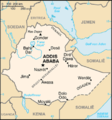


_distr02.png/105px-Eurocephalus_(Genus)_distr02.png)


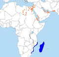




.png/120px-Geographical_frequency_distribution_of_Haplogroup_J1-M267_(Y-DNA).png)
.png/120px-Geographical_frequency_distribution_of_Haplogroup_J2a-M410_(Y-DNA).png)
.png/120px-Geographical_frequency_distribution_of_Haplogroup_J2b-M102_(Y-DNA).png)
.png/120px-Geographical_frequency_distribution_of_Haplogroup_J2b1-M205_(Y-DNA).png)
.png/120px-Geographical_frequency_distribution_of_Haplogroup_J2b2-M241_(Y-DNA).png)


.png/120px-Global_frequency_distribution_map_of_haplogroup_Q-M242_(Y-DNA).png)






.svg/120px-Iraq_(orthographic_projection).svg.png)


